Disappearing in Yosemite: A Solo Journey Through Silence and Stone
Ah, sometimes I grow so tired
But I know there’s one thing I got to do…. RAMBLE ON…
-Led Zeppelin
I’d been counting down the days to this trip. I needed to disappear for a little while—slow down, unplug, disconnect from the noise, and reconnect with myself. Life’s been heavy lately, and I knew I needed a reset. What better place for that than Yosemite?
I’ve been lucky enough to visit the park hundreds of times, but when I need to calm my soul, I always find myself coming back. This time was no different. I had a few goals: shake the rust off my cross-country navigation skills, visit a couple of lakes without trails, test my new Garmin InReach Messenger Plus, try out some new recipes, and explore a part of Yosemite I’d never seen—the upper Illilouette drainage.
My Bronco was packed by Tuesday. After finishing my 4:00–8:30 p.m. shift at REI, I hit the road. A quick Chipotle stop later, I headed up Highway 140 toward the mountains. Just before midnight, I pulled over a few minutes from the Yosemite sign, inflated my DeepSleep mattress, and crawled into the back of the Bronco. It was warm—almost hot—in the Merced River canyon, so I rolled down the back window and drifted off to the sound of the river. My alarm was set for 6:00 a.m.
After a surprisingly great night of sleep, I passed through the entrance gate by 6:30. I swung by Yosemite Lodge to grab a Starbucks coffee (still weird to me that there’s a Starbucks in Yosemite), a bagel, and some Greek yogurt. I ate alone at a picnic table, watching sleepy tourists wander out of the lodge. Then I cleaned up, brushed my teeth and I was off to pull my permit.
At the backcountry ranger station, I was the first one there. Eventually a few people joined the line. When the doors opened at 8:00, I was first in. While talking with the ranger about my route, the guy next to us—decked out in tie-dye—was loudly arguing about Half Dome permits and bear cans. I exchanged a knowing look with the ranger and said, “Can’t wait to get away from all that noise.”

My tracks on Avenza Maps, starting and ending at Ostrander Lake Trailhead.
The ranger looked over my CalTopo route and signed off. Day one to Ostrander Lake was straightforward. Day two would involve 3–4 miles of cross-country hiking. I drove to the Ostrander Lake trailhead on Glacier Point Road. Years ago, I used to hide a beer in the woods for the end of a hike. These days, I hide a Diet Pepsi. I stashed one, shouldered my pack, and hit the trail.
I hadn’t been to Ostrander in over 30 years. Last time, I camped after summiting the prominent peak above the lake. The lake feeds Bridalveil Creek, which eventually becomes the iconic Bridalveil Falls in the valley. The hike in was as I remembered—two flat miles, then a steady three-mile climb through a burn scar, followed by the infamous “Heart Attack Hill,” and finally a gentler push to the lake.
And there it was—Ostrander, still just as gorgeous. I wandered past the main campsites to find solitude and set up in a quiet spot with a flat tent pad, granite windbreak, and rocks to sit on. By 3:00 p.m., I was home.

My campsite at Ostrander Lake (Southwest shoreline)
I soaked my feet in the icy lake—still frozen just two weeks earlier—and breathed in the quiet. To my surprise, I had the place to myself… until the marmots arrived. Two of them. Bold, curious, and clearly experienced. One tried to eat my sun shirt. The other straight-up stole my sunglasses and ran off. I got them back—minus the rubber pieces. After marmot-proofing camp, we found a truce.

Dinner was tortillas with mozzarella, pepperoni, shiitake mushrooms, and pasta sauce. Dessert: Haribo gummy bears. I was in my tent by 8:00 p.m.
Morning came at 7:00 a.m. I unzipped my tent and was instantly greeted by a marmot munching grass five feet away. I made a warm cup of Verve coffee and tried out a new breakfast: rehydrated mango, pineapple, ginger crystals, blueberries, and strawberries, topped with granola and coconut. It was an absolute win—and the leftover broth? Delicious.

Ostander Lake at first light
After packing up and saying goodbye to my marmot neighbors, I began the off-trail section of the journey. My landmarks were a small tarn above Ostrander, Horse Ridge, and eventually Hart Lake. From there, I’d aim for Edson Lake, then down the drainage to reconnect with Buena Vista Trail.
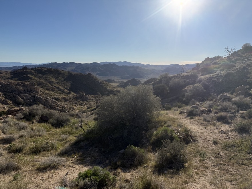
Cross-country travel is a different kind of challenge. You pick a landmark, move toward it, then repeat—always checking your map and terrain. I made it to the tarn, which had a beautiful little waterfall, then scrambled up Horse Ridge. The view from the top was stunning: the Clark Range, Red Peak, Gray Peak, Mt. Clark, and the backside of Half Dome in the distance.
Next came the spicy bit: a steep talus slope. I picked my way down, testing every rock with my trekking pole. It was slow and mentally draining, but after 30 minutes, I stood at Hart Lake. It was gorgeous—half ringed with trees, the other half granite slabs perfect for jumping.
After soaking in the beauty and solitude, I continued down the drainage toward Edson Lake. The first half mile was smooth, and I started to feel confident—maybe too confident. Soon I was high-stepping over fallen trees, bushwhacking, slogging through swamps, and squeezing between pine trunks. It was brutal. Just when I was questioning whether Edson was worth it, I saw the lake through the trees.
I reached the shore, dropped my pack, and sat quietly, taking it all in. I could see the distant ridge I’d come from. I’d made it. Two off-trail lakes, navigated by map and instinct. I had a tortilla, some salami, and a Jolly Rancher.
Then I headed down the drainage toward Buena Vista Trail, hopping over creeks, following the path of least resistance, and eventually climbing a small crest where the landscape opened up. I reached the trail at last.
From there, it was a long, slow descent of 2,000 feet through a fire-scarred forest of blackened cedar and pine. No shade, just heat. I stopped at a creek, filtered water, ate some jerky, and kept going. I passed the campsite I’d planned on, but I had gas left in the tank, so I pushed on toward the Mono Meadow Trail junction.
Eventually I reached a creek crossing, and just above it, I spotted a flat spot on the edge of a meadow with a view of Mt. Starr-King. That was home for the night. I set up camp, filtered water, and cooked up penne with shiitake mushrooms, red bell peppers, chipotle, and Aidells Andouille sausage. I was so hungry I didn’t wait for the pasta to fully rehydrate. It was still amazing. I crawled into my tent and watched Becoming Led Zeppelin before falling asleep.

Night #2’s campsite with Mt. Starr-King in the background
I woke up early—alarm set for 6:00 a.m., but I was packed up and hiking by 5:15. My tent was soaked with condensation, and I had to shove it away wet and dirty. By 6:30, I was at Mono Meadow Trail, where I passed four campers—the first people I’d seen in over 36 hours. It struck me: I hadn’t spoken to anyone in more than 40 hours, not since the woman I passed on day one. Proof that solitude still exists in Yosemite if you’re willing to earn it.

Hiking under a full moon before sunrise
The final climb was brutal. Mono Meadow Trail is steep—up or down. I had three miles and 600 feet of exposed, hot uphill ahead. Once I crested the ridge, the next two miles were easier, but the creek crossing was knee-deep. Then came Mono Meadow itself—wet, muddy, and mosquito-ridden. Almost there.
The last two obstacles: a cruelly steep final ascent to the parking lot, followed by a 1.5-mile road walk. I passed fresh hikers coming down and kept wondering why the trail builders didn’t believe in switchbacks. Then I rounded a corner—and there it was. The Mono Meadow Trailhead. I’d made it.
I packed away my poles, walked the asphalt, and spotted my Bronco. The lot was full now, and I smiled. One of the benefits of retirement: I was ending my hike on a Friday, not starting it. I stripped out of my sweaty clothes, changed into fresh ones, and walked to the meadow behind the lot. Hidden in the roots of an incense cedar tree was my prize: a cold, untouched Diet Pepsi.

Another trip in the books.
I fired up the Bronco, took one last loop through Yosemite Valley, and headed home. I stopped at 1850 Brewery for a burger and a soda, and descended into the sunbaked Central Valley before reaching the foggy, familiar coast of Santa Cruz County.
Until next time… happy trails.
Trip Takeaways:
Meals: The granola breakfast and homemade rehydrated pasta were both hits. The sausage was delicious but greasy—next time, I’ll clean the pot even more thoroughly to avoid attracting critters.
Garmin InReach Messenger: A total win. Way faster and easier than the Mini. Messages were lightning fast, the weather forecasts were accurate, and I finished the trip with 51% battery—no recharging needed.
CalTopo: Yet again, it proved invaluable. It guided me across miles of off-trail terrain flawlessly.
Gear: I wore a Patagonia Capilene Cool long-sleeve sun shirt. Great drying and odor control—but no thumbholes, which bugged me. I’ll stick with the Outdoor Research Echo shirts from now on.